Svartberget research station

Facilities
Station name and owner
Svartberget Reseach Station belongs to the Faculty of Forest Sciences, Swedish University of Agricultural Sciences (SLU).
Location
The research station is located in the northwestern part of Sweden in the province of Västerbotten. The station is surrounded by a 2500 ha research area including forests, mires, lakes, and waterways. Since 1923, the area has been used for research only. Mixed coniferous forest dominates the experimental site and the bedrock consists almost entirely of gneiss. The dominating type of soil is moraine of various thickness. SLU and the Faculty of Forest Sciences have the mandate from the Government of Sweden to take national responsibility for forestry related research. To do this, SLU has four field stations, including Svartberget, all being manned throughout the year. The research station at Svartberget is located near Vindeln, 60 km west of Umeå, close to the Vindel River, which is a protected national river, free of hydro-power dams.
Climate data
Grey colours are WMO Climate Normals including maximum and minimum values. Blue colours are individual years.
Climate data for the stations where extracted via Copernicus Climate Data Store, from the global gridded reanalysis product:
ERA5 monthly averaged data on single levels from 1940 to present.
Description and source code: Roemer J.K. 2023. https://doi.org/10.5281/zenodo.10214922
Data Source: Hersbach et al. 2023. Copernicus Climate Change Service (C3S) Climate Data Store (CDS), https://doi.org/10.24381/cds.f17050d7
Biodiversity and natural environment
The climate is characterized as cold temperate and humid with persistent snow cover during the winter season. Moose are frequently observed and brown bears live in the area. The region is a winter grazing area for domestic reindeer.
History and facilities
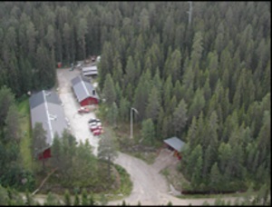
The research station was established in 1923. The current field station was built in 1979 and offers laboratory facilities, offices, internet, power tool workshops and equipment for instrument calibration. The laboratory is equipped with refrigerator, ovens, freezers and scales. The field station also holds a lecture room for up to 20 persons. High power electricity and fibre-optical cables for communication are distributed in the field to 15 different sites. Accommodation of different standard is available for visiting scientists in the small town of Vindeln, 6 km from the station. Meals can also be prepared by the vising scientists themselves in the station kitchen.
General research and databases
The field research infrastructure hosts a number of closely integrated, long-term field research programs that individually offer state-of-the-art experimental platforms, empirical data, and field opportunities.
Station Monitoring
Human dimension
The town Vindeln, 6 km from the station, has approximately 2500 inhabitants and offers grocery stores, gas stations, a hardware shop, a drugstore, and a district health care centre. There are several small villages along the Vindel River (450 km). Forestry and manufacturing forest industry are the main employers in the region. Various outdoor activities like fishing, hunting, skiing, berry picking, mushroom collecting and other recreational activities play an important role in the daily life for the local inhabitants.
Access
The research station is one hour’s drive from the Umeå Airport and the two universities of Umeå: SLU and Umeå University. The research facilities are located 6 km north of the town Vindeln and can be reached by road throughout the year. Vindeln can be reached by bus or train, and the field station can at times provide transportation between Vindeln and the station.